Hi all .
I do not know how accurate this map is but it is posted
on an Egyptologist's website so I assume it must be reasonably close. Would dearly love a totally accurate one but nevertheless on to the title of the post ... (NOTE: Please when you get to link ... click on 'Monuments" and then "Dashur" )
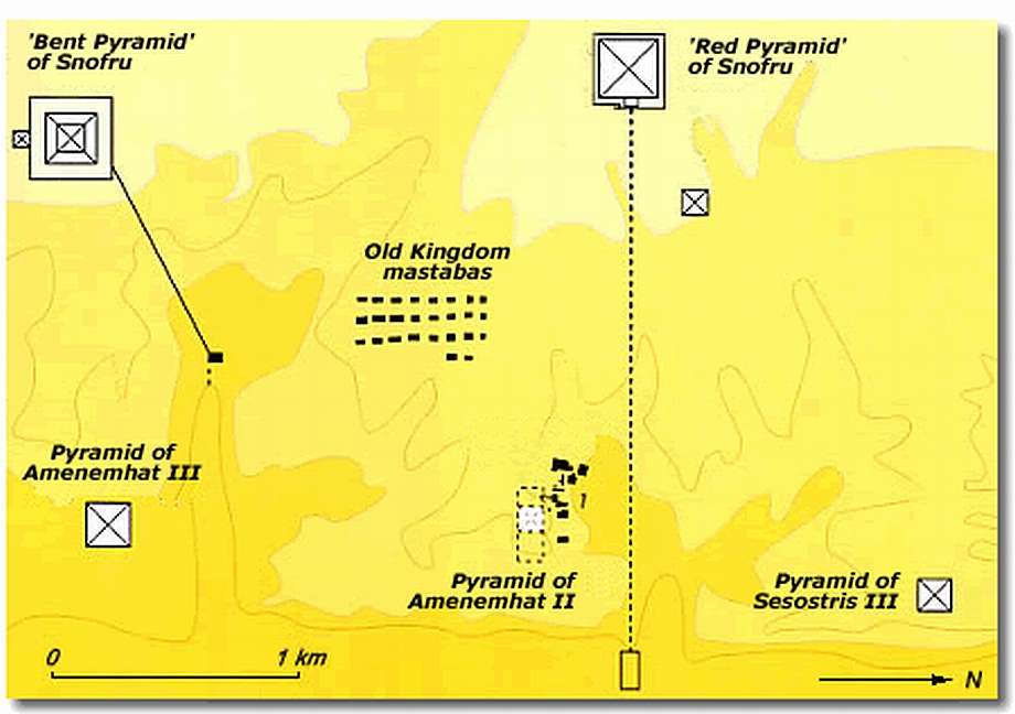
Image 1:
The Dashur Pyramid field ...
[
img204.imageshack.us]
-------------------------------------------------------------------------------
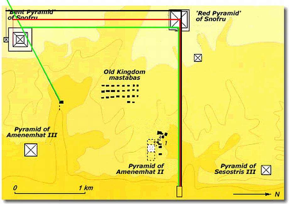
Image 2:
Showing some right angled lines and please note that the green lines are equal as are the red and black lines and are drawn at a 90 degree angle to each other and all use the East-West line of The Red as a base.
[
img175.imageshack.us]
------------------------------------------------------------------------------
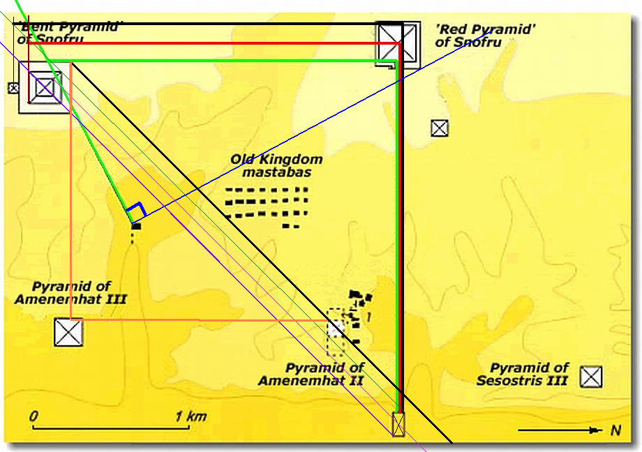
Image 3:
More lines drawn at 45 degrees and another light brown one at 90 degrees. Amazing how all of a sudden the placement of Amenemhat's Pyramid no longer seems random at all.
[
img175.imageshack.us]
-----------------------------------------------------------------------------------------
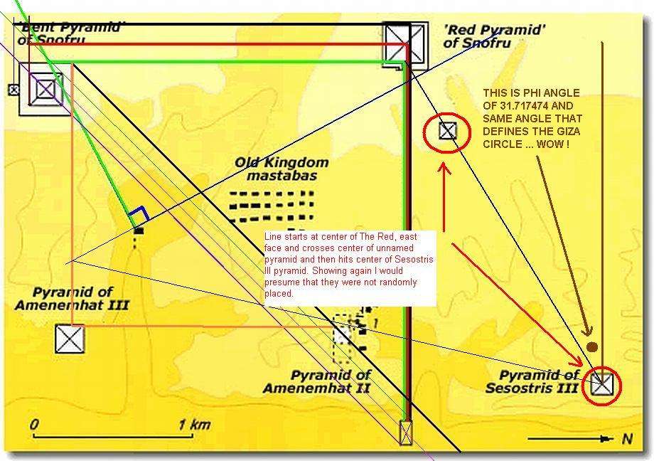
Image 4:
In this image an interesting angle is found and a logical reason for the placement of Sesostris III's pyramid is realized. So I would hazard a guess that a design was completed here many years later. Or at the very least a plan was followed in the 12th dynasty
[
img250.imageshack.us]
----------------------------------------------------------------------------
There is most probably more but let us absorb this much first.
Cheers
Don Barone
"There is nothing as impenetrable as a closed mind"
and ..." if everything is a coincidence what is the point of studying or measuring or analyzing anything ?" db
Edited 3 time(s). Last edit at 01/24/2008 11:19AM by Ahatmose.


